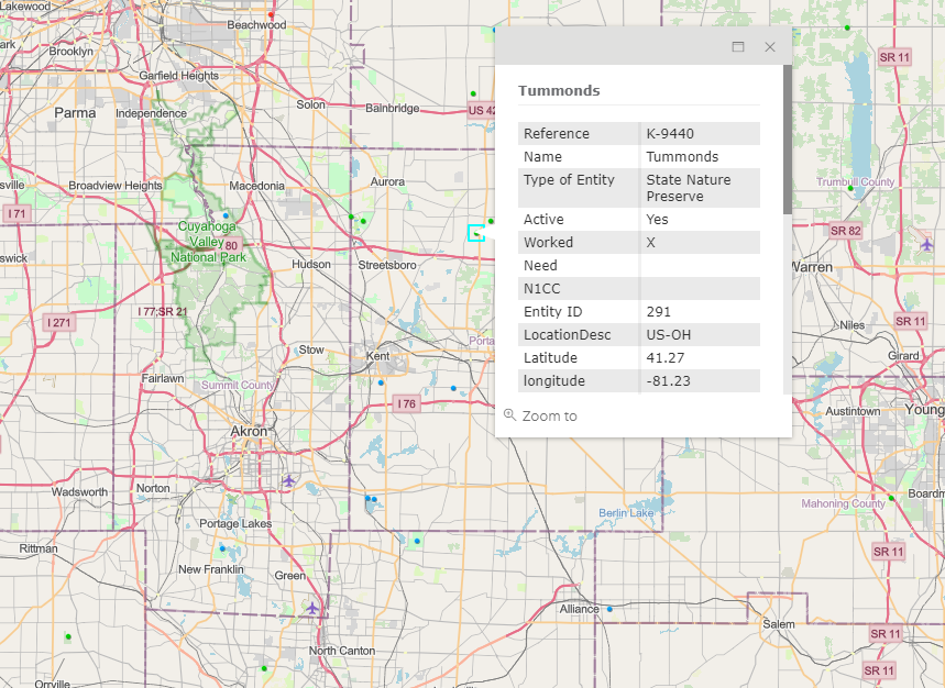
US-9440 (Tummonds SNP) is a hike in activation. It’s located in Mantua (Portage County), OH. To my knowledge, there is no drive-in access to this one.
The Cuyahoga River runs through it, so access via the water is a possibility. I wanted to try hiking in, so that meant entering via the Rotary Glacial Esker trail on City of Mantua property.
I had to research several different sites (See references below) to figure out where the City of Mantua ends, and Tummonds actually begins. But, finally came up with the following:
This is a Hike-in activation of maybe 3/4 of a mile.
Park at the Water Department building at 4466 Mats Rd, Mantua. This is where you access the trail.
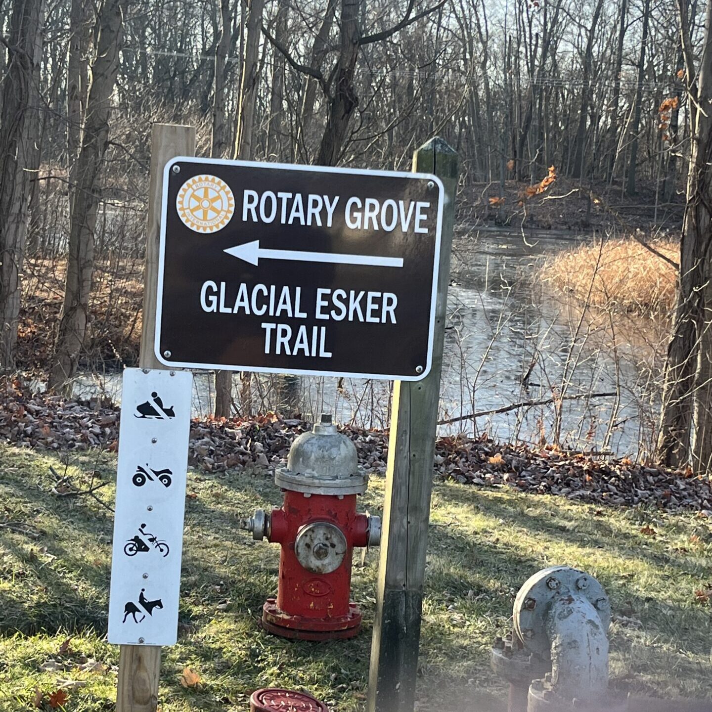
Follow the trail where it loops around the East end of the lake, and along the South shoreline. The trail is actually a driveway (probably so that the city can get their service trucks around to service the well pumps that are spaced along the trail).
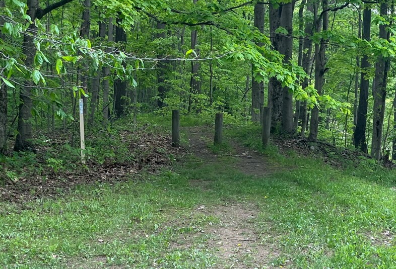
At the end of the trail, you will see 3 posts. This is the beginning of the Nature preserve (Coordinates: 41°16.459, -81°14.014). I hiked further to a high spot around 4-500′ past the posts.
Note that from the clearing near the posts, you can look both ways to see a Gas pipeline Right of Way. Of course you can’t bring a vehicle up that one, but it may make for an interesting hike for the adventurous.
Reference
ODNR GIS map: https://gis.ohiodnr.gov/MapViewer/?config=ODNRLands
Birdinghotspots.org: https://birdinghotspots.org/hotspot/L11285111
Portage County GIS Map: https://portagecounty.maps.arcgis.com/apps/webappviewer/index.html?id=8e508a935a434cb88edc4eb302310644